

Why Drive Türkiye's High Country?
Most travelers experience Türkiye at sea level: the Bosphorus ferries, the beaches of Antalya, the fairy chimneys of Cappadocia. But climb a few thousand meters and the country transforms. Türkiye is a nation of mountains—the Pontic Alps along the Black Sea, the Taurus range arcing across the south, the volcanic giants of the east like Mount Ararat and Süphan. Between them lie high plateaus, yaylas, where shepherds still move with the seasons and where summer brings cool air, wildflowers, and panoramas that stretch for a hundred kilometers.
Driving these passes is not just about the destination. It is about the road itself: switchbacks carved into cliff faces, single-lane tracks across flower-strewn meadows, and the sudden thrill of emerging above the treeline into a world of rock, sky, and silence. The rewards are immense, but so are the challenges—fuel stations can be sparse, weather can turn in minutes, and snow may linger into June on the highest cols.
This guide covers the most rewarding mountain drives in Türkiye, with practical notes on fuel, road conditions, weather windows, and where to sleep. It also celebrates the people who make these journeys unforgettable: the village hosts who offer tea, a bed, and a story when you least expect it.
Planning Your Mountain Drive: Seasons, Vehicles, and Supplies
The prime window for high-altitude driving in Türkiye is late May through early October. Snow can block passes well into June, especially in the east, and the first autumn storms often arrive by mid-October. July and August are the most reliable months, but also the busiest on popular routes like the Kaçkar and the Taurus coastal passes. For solitude, aim for June or September, when the weather is still stable but the crowds have thinned.
Vehicle choice matters. A standard car can handle most paved passes, but for yayla roads—often gravel or dirt—a high-clearance vehicle or a small SUV is advisable. Diesel is widely available, but in remote areas, fill up whenever you see a station. Carry a jerrycan if you plan to venture deep into the Kaçkar or the Taurus. Also pack: a physical map (GPS can fail), a power bank, warm layers, rain gear, and cash (many village pensions and fuel stops don't accept cards).
Turkish drivers are generally skilled on mountain roads, but be prepared for trucks cutting corners and livestock on the road. Drive defensively, use your horn on blind bends, and never rush. The journey is the point.
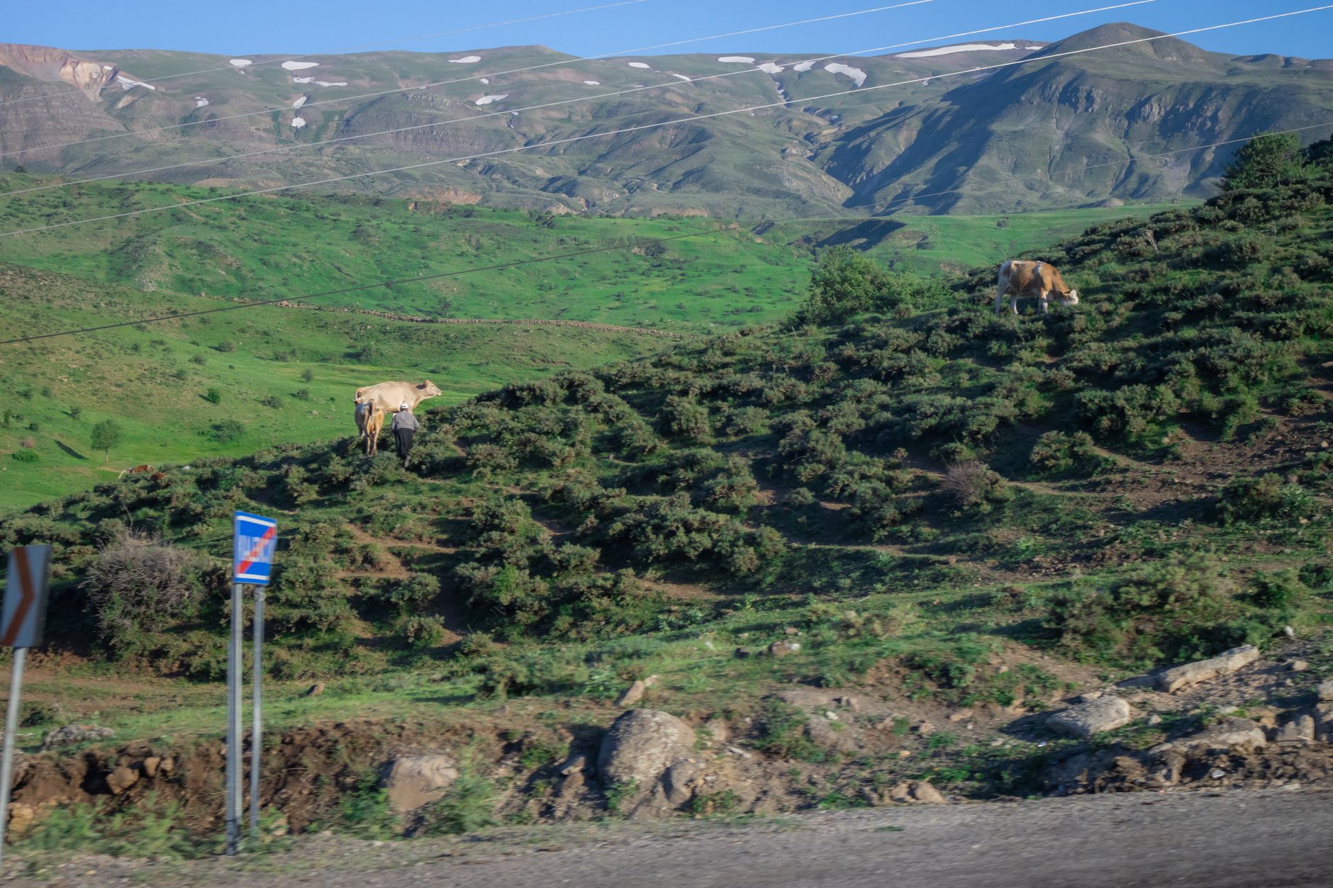
The Taurus Mountains: Gates to the Mediterranean
The Taurus range forms a massive wall between the Anatolian plateau and the Mediterranean coast. Several passes cross it, each with its own character. The most famous is the Sertavul Pass (1,650 m) on the road between Karaman and Silifke. The climb is gradual, but the descent into the Göksu Valley is spectacular, with views of the sea shimmering in the distance. Fuel is available in Karaman and Mut; the pass itself has a small café at the summit.
Further west, the Gülek Pass (also known as the Cilician Gates) has been a trade route since antiquity. The modern highway tunnels through, but the old road still winds over the top, offering a sense of history and sweeping vistas. For a more adventurous route, try the Alacabel Pass between Konya and Antalya—a high, lonely road that stays above 1,800 m for kilometers, with snow patches often lingering into May.
The Taurus is also home to the Taşeli Plateau, a remote highland of limestone peaks and traditional villages. Roads here are rough but rewarding. Fill up in Ermenek or Başyayla, and consider an overnight in a village guesthouse—hosts often serve fresh yogurt, flatbread, and endless tea.
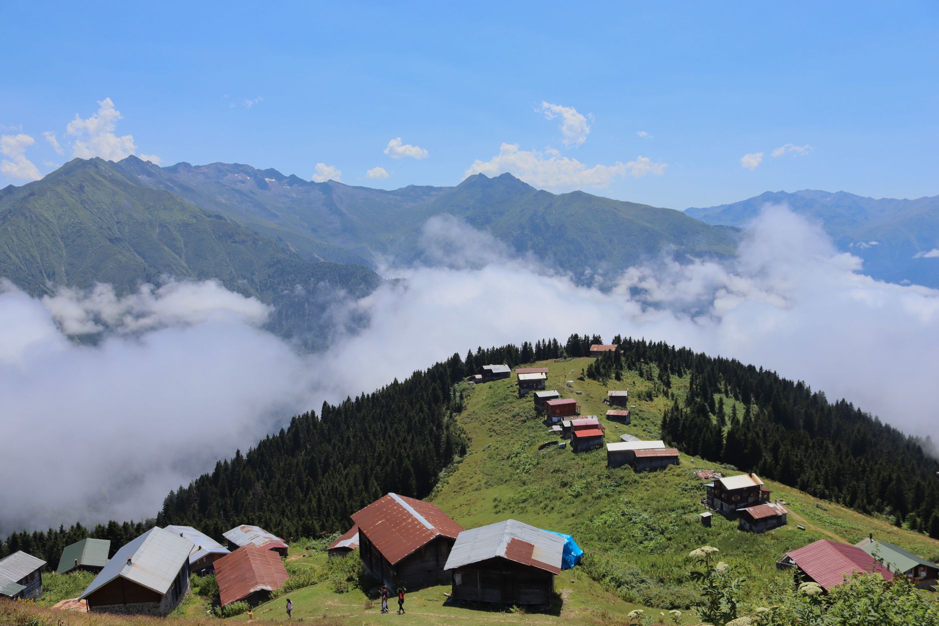
The Kaçkar Mountains: Black Sea Highlands
The Kaçkar range in northeast Türkiye is the country's premier alpine playground. Rising to 3,937 m, it offers glacier-carved valleys, turquoise lakes, and yaylas that feel like a different world. The main gateway is Ayder Yaylası, a bustling resort town at 1,350 m. From there, a paved road climbs to Gito Yaylası (2,100 m) and beyond to Pokut and Sal, two high pastures with unforgettable views of the Kaçkar peaks.
These roads are narrow, steep, and often unpaved, but a standard car can manage in dry weather. Fuel is available in Çamlıhemşin and Ayder, but not higher up. Weather is notoriously changeable: fog, rain, and even summer snow are possible. Always carry rain gear and warm layers, even in August.
Accommodation in the Kaçkar is a highlight. Family-run guesthouses in Ayder, Pokut, and Gito offer simple rooms, hearty Black Sea cuisine (think cornbread, kale soup, and fresh trout), and a warm welcome. In Pokut, the sunrise over the clouds is worth the bumpy drive alone.

The Pontic Alps: Green Passes and Cloud Forests
South of the Black Sea, the Pontic Mountains (Doğu Karadeniz Dağları) run parallel to the coast, creating a lush, misty world of cloud forests and tea plantations. The Zigana Pass (2,050 m) on the Trabzon–Gümüşhane road is one of the most accessible high passes, with a well-maintained highway and a tunnel for those in a hurry. But take the old road over the top for spectacular views and a sense of the old Silk Road.
Further east, the Soğanlı Pass (2,400 m) connects Bayburt to Of, climbing through alpine meadows where yayla festivals take place in summer. The road is paved but winding; fuel up in Bayburt or Of. The Çoruh Valley, accessed via the Ovit Pass (2,640 m), is another gem, with the roaring Çoruh River cutting through deep gorges. The Ovit Tunnel now bypasses the pass, but the old road remains a thrilling drive.
These mountains are wet: annual rainfall can exceed 2,000 mm. Come prepared for rain, and you'll be rewarded with emerald landscapes and waterfalls cascading down every cliff.
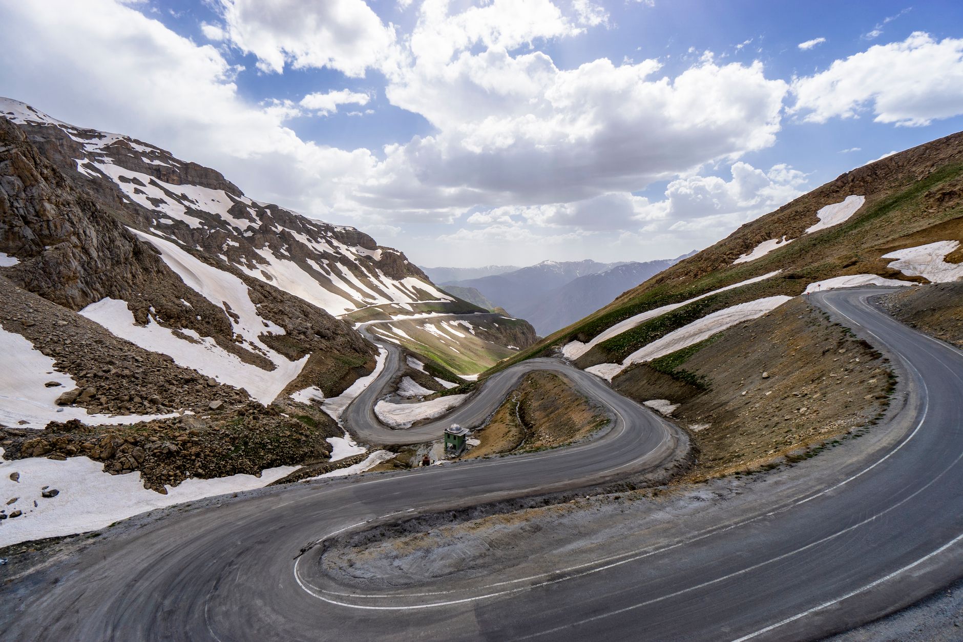
Eastern Anatolia: Volcanoes and Remote Plateaus
Eastern Türkiye is a land of extremes: vast steppes, snow-capped volcanoes, and some of the highest roads in the country. The Taurus and Pontic ranges are just a warm-up. Here, you can drive to 2,500 m and beyond on paved roads, often with no other car in sight.
The Mount Ararat region is legendary, but the mountain itself is off-limits without a permit. However, the surrounding roads, like the one from Doğubayazıt to Iğdır, offer stunning views of the peak. The Lake Van basin is ringed by mountains, and the Nemrut Dağı (not the one in the southeast) near Tatvan has a crater lake at 2,250 m, reachable by a rough road.
Further north, the Kaçkar and Yalnızçam ranges offer remote passes like the Çam Pass (2,600 m) between Erzurum and Artvin. Fuel stations are scarce; fill up in Erzurum or Artvin. The High Plateau of Erzurum is a vast, treeless expanse where you can drive for hours with only sheep and shepherds for company. Guesthouses in villages like Uzundere or Tortum provide a cozy base.
Fuel, Food, and Village Hospitality
In the mountains, fuel stops are more than just petrol stations—they are lifelines. In remote areas, a station may be the only sign of civilization for 50 km. Always top up when you can. In the Kaçkar, the last reliable fuel is in Çamlıhemşin; in the Taurus, fill up in Mut or Ermenek. In the east, Erzurum and Van are major hubs.
Food is another consideration. Village restaurants (lokantas) serve hearty, home-cooked meals: bean stews, grilled meatballs, and rice pilaf. In the high yaylas, you might be invited into a shepherd's tent for tea and conversation. Accepting is not just polite—it's the highlight of many trips. The kindness of village hosts is legendary. In places like Pokut or Barhal, you may be offered a bed for the night even if you haven't booked.
Guesthouses (pansiyon) are common in popular areas, but in remote villages, you may rely on homestays. Prices are modest, and the experience is priceless. Learn a few words of Turkish—teşekkür ederim (thank you) goes a long way.
Weather Windows and Safety on High Roads
Mountain weather in Türkiye is unpredictable. Even in July, a sunny morning can turn to fog and rain by afternoon. Check forecasts (Meteoroloji Genel Müdürlüğü is the official source) and be prepared to turn back. Snow can fall any month above 2,500 m. If you're crossing a high pass, start early and aim to be down by mid-afternoon.
Road conditions vary. Main highways are well-maintained, but secondary roads can be narrow, unpaved, and prone to landslides after rain. In the Black Sea region, fog is a constant companion. Drive with headlights on, use low gears on descents, and don't rely on guardrails—many don't exist. Mobile coverage is spotty; download offline maps.
Despite the challenges, the reward is immense: cool air in summer, wildflower meadows, and views that make you feel on top of the world. With careful planning and a spirit of adventure, Türkiye's mountain passes will be the most memorable part of your journey.
Sample Itineraries for Mountain Lovers
One-week Taurus loop: Start in Antalya, drive north over the Alacabel Pass to Konya, then east to Karaman and over the Sertavul Pass to Silifke. Return along the coast. Highlights: Göksu Valley, ancient ruins, and village guesthouses.
Ten-day Kaçkar and Pontic adventure: Fly to Trabzon, drive to Ayder, explore the yaylas (Pokut, Gito, Sal), then continue east over the Ovit Pass to Erzurum. Return via the Zigana Pass. Highlights: alpine lakes, cloud forests, and Black Sea hospitality.
Two-week eastern expedition: For experienced drivers, start in Erzurum, head to Kars, then south to Doğubayazıt and Lake Van. Cross the Taurus via the Gülek Pass to finish in Mersin. Highlights: Mount Ararat views, crater lakes, and remote plateaus.
Whichever route you choose, remember that the journey is as important as the destination. Take your time, talk to locals, and savor the cool mountain air. Türkiye's high roads are waiting.
Thinking about a trip to Turkey?
Share your contact details and a vetted local expert will follow up with a plan built around you — free, no obligation.